
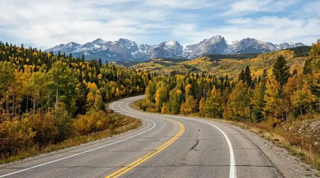
Rachel had Friday off, but not much else. She had three days, a half-full tank of gas, and a standing agreement with her partner that nobody was spending the entire weekend trapped in a car just to say they had “done fall foliage.”
Still, she wanted the leaves. She wanted one of those October mornings when the trees along the road are yellow and red, when the air feels cold enough for a sweater, and when stopping for coffee somewhere small and unfamiliar feels like part of the trip rather than a detour.
So she opened her laptop and searched for fall foliage road trips. The results were beautiful. They were also, in many cases, terrible suggestions for a three-day weekend.
Some of the most famous foliage destinations were several states away. Others looked manageable until Rachel added the Friday afternoon traffic, the Sunday drive home and the inevitable stops that happen when two people are traveling together.
By the time she reached the part of the itinerary where she was supposed to “enjoy the scenic drive,” she was already doing the math on how much of Saturday would be spent driving.
She closed the laptop.
The problem wasn’t that the famous places weren’t worth visiting. It was that Rachel was trying to solve a three-day problem with a destination-first mindset. She needed a different kind of fall foliage trip.
The problem with chasing the “best” fall foliage
A three-day weekend changes the calculation. If you have a week, driving six or seven hours to reach a famous mountain region may make sense. You can absorb the long drive, spend several days exploring and wait for the right stretch of weather.
With Friday through Sunday, every extra hour behind the wheel comes directly out of the trip. That is especially important because fall color isn’t a stationary event waiting for travelers to arrive; it moves.
Day length, temperature and precipitation all influence the timing and intensity of fall color, and the National Park Service notes that predicting the exact timing of peak foliage remains difficult.
Elevation adds another layer. In mountainous areas, higher elevations can begin changing before lower valleys, allowing color to develop in stages rather than everywhere at once. Shenandoah National Park, for example, says its higher elevations change first, with color gradually moving down the mountains.
That makes a route more useful than a single destination: if the leaves are early, you can go higher; if they’re late, you can move lower. If one overlook is crowded, you don’t have to spend your entire Saturday waiting for a parking space.
Most fall travel guides name the destination and leave the rest to the traveler. They don’t always account for weekend highway bottlenecks, rural EV charging or the way foliage can change with elevation.
Rachel had been asking, “Where should I go?”
The better question was: What is the best fall foliage experience I can realistically reach from my city in three days?
That small change turns a foliage trip into a route-planning problem. At least the route was something she could control.
Think in regions, not one perfect weekend
Fall foliage interest rises as the season approaches, but the timing varies considerably by region. Elevation bands can create more flexibility. That doesn’t mean every place peaks at the same time. It means travelers should pay attention to local reports rather than choosing a date months ahead and assuming the trees will cooperate.
A better three-day plan usually has three ingredients:
- a driving radius of roughly four hours or less;
- more than one foliage zone within the region;
- a route that gives you somewhere else to go if conditions change.
Here are five places where that approach makes sense.
New York City → Catskills
Approximate driving range: Within roughly four hours of the NYC metro, depending heavily on where you start and Friday traffic.
The Catskills work well for this kind of weekend because the region isn’t one single viewing point. It contains mountains, valleys, reservoirs, small towns and winding secondary roads. Several scenic routes run through the region.
The Catskills tourism authority describes the region as a short drive from the NYC/NJ/CT metro area, while the Catskill Mountains Scenic Byway runs for 52 miles through mountain and forest country. The timing is useful, too. Catskills tourism guidance says foliage typically begins turning in late September and often peaks around the second week of October, while New York’s environmental agency notes that the Catskills and Adirondacks can see peak color from the final weeks of September into early October.
Friday: Leave the city as early as realistically possible. Make the drive part of the transition rather than trying to pack a full sightseeing day into Friday evening. Stay in or near the section of the Catskills you want to explore most.
Saturday: Build the main scenic loop around mountain roads rather than driving from attraction to attraction. The Catskill Mountains Scenic Byway and surrounding secondary roads give you room to adjust the route as conditions change.
Sunday: Start with a lower-elevation or valley stop before beginning the drive home. Leave enough time for traffic rather than turning Sunday afternoon into a race against the clock.
Why the geography helps: The Catskills give you both higher mountain roads and lower landscapes. That means you aren’t dependent on one exact patch of forest being at peak color.
Traffic: Friday afternoon leaving NYC and Sunday afternoon returning can easily undermine the point of a short getaway.
EVs: Check current DC fast-charging locations along your chosen Catskills route before departure.
If color is early or late: Move your route toward higher or lower elevations rather than abandoning the weekend.
Washington, D.C. → Shenandoah
Approximate driving range: Within a roughly four-hour target from the D.C. metro, depending on the entrance and starting point. This is one of the clearest examples of why elevation matters. Shenandoah National Park stretches along the Blue Ridge, and Skyline Drive follows the crest for 105 miles, connecting overlooks, trailheads and visitor facilities.
The National Park Service warns that fall weekends bring both foliage and large crowds. Its northern entrances, particularly Front Royal and Thornton Gap, can have longer waits, and the park recommends considering alternative approaches and circuits. That is exactly the kind of information that changes a three-day trip.
Friday: Drive toward the Shenandoah area after work if traffic allows, but don’t insist on reaching the deepest part of the park that night. Base yourself where Saturday’s route will be easiest.
Saturday: Use Skyline Drive as part of a larger loop rather than treating the entire road as something you must complete. Stop for an overlook, take a short walk and move on before the day becomes a sequence of parking-lot searches.
Sunday: Work your way through lower-elevation scenery before heading back toward D.C.
Why the geography helps: Shenandoah’s changing elevations create a natural progression in fall color. The park says color generally moves from higher elevations down the mountain, and it is impossible to identify one accurate peak date for the entire park.
Traffic: This is a major part of the route, not a footnote. The National Park Service describes fall as a busy season and is running an extended traffic-safety campaign through November 15, 2026, covering the fall foliage season.
EVs: Charging options are limited along Skyline Drive, so check current charging locations before choosing a rural loop.
If color is early or late: Check the park’s current fall-color updates and webcams before deciding which section to drive. Shenandoah provides several tools specifically because color varies dramatically across the park.
Philadelphia → Pocono Mountains
Approximate driving range: A practical short-trip region for the Philadelphia metro, but exact drive time varies substantially by starting point and weekend traffic. The Poconos work because the region is large enough to function as a weekend landscape rather than a single attraction. The Pocono Mountains Visitors Bureau describes the Pocono Mountains as a 2,400-square-mile region with forests, rivers, mountains and waterfalls, and its official foliage itinerary is explicitly structured as a three-day trip. That is useful for a traveler who wants the trip to feel like a trip without spending half of it getting there.
Friday: Head north after work and settle into a base that leaves you close to the Saturday driving loop.
Saturday: Make the day about the landscape. A route around the Lehigh Gorge and surrounding mountain roads can combine driving with a walk, overlook or other outdoor stop instead of stacking five separate attractions onto the itinerary. Pennsylvania’s official three-day foliage itinerary uses the Lehigh Gorge as one of its central stops.
Sunday: Choose a different direction through the region before returning south. The goal is to see a second landscape, not repeat Saturday’s drive.
Why the geography helps: Pennsylvania has a long foliage season, and state tourism guidance divides the season into regional windows rather than treating the whole state as one peak.
Traffic: Leave enough time for weekend traffic around the chosen Pocono corridor.
EVs: Check current charger locations before heading into the more rural sections of your route.
If color is early or late: Shift between higher mountain terrain and lower areas rather than locking yourself into one viewpoint.
Boston → Berkshires
Approximate driving range: About two hours from Boston, depending on your destination within the Berkshires and weekend traffic.
The Berkshires tourism authority makes the case for thinking about foliage as a geographic progression. The region stretches from north to south and includes both valleys and some of Massachusetts’ higher elevations. Its current 2026 foliage guidance specifically says there isn’t one perfect weekend: northern and higher areas can begin changing in late September, while southern areas can continue showing strong color into mid- and late October.
Friday: Leave Boston with enough time to arrive before the evening disappears. Stay somewhere that puts you within easy reach of the scenic roads you want to drive.
Saturday: Take a scenic road rather than spending the day moving between named attractions. The Mohawk Trail along Route 2 is one established foliage route in the region.
Sunday: If the northern Berkshires were already changing on Saturday, head south. If the north is still mostly green, stay lower and explore the southern part of the region instead.
Why the geography helps: The north-to-south variation gives you a built-in backup. The region’s own 2026 guidance recommends following the color rather than treating one calendar date as guaranteed.
Traffic: Allow extra time on peak foliage weekends, particularly on your chosen scenic route.
EVs: Check current charging options before heading onto rural Massachusetts routes.
If color is early or late, change the direction of the trip.
Atlanta → North Georgia Mountains
Approximate driving range: A manageable weekend drive from the Atlanta metro, depending on your starting point and weekend traffic. For Atlanta travelers, the foliage strategy changes slightly. The North Georgia mountains provide elevation without requiring a trip to New England, and higher peaks can begin changing before lower areas.
Explore Georgia points to Brasstown Bald, at 4,784 feet, as one of the first places in the state to show fall color. The region also offers mountain roads such as the Richard B. Russell Scenic Highway and Wolf Pen Gap Road. Georgia’s state tourism guidance generally places its strongest fall-color period in October and November, while its Leaf Watch program provides updates as the season progresses.
Friday: Leave Atlanta and make the mountain town or valley community your overnight base.
Saturday: Drive the higher mountain roads in the morning, then descend into lower elevations for the afternoon. That gives the day two different landscapes without requiring a huge mileage total.
Sunday: Take a different route home rather than trying to repeat Saturday’s loop. If the weather or foliage timing isn’t cooperating at the highest elevations, spend more time at lower elevations.
Why the geography helps: North Georgia’s mountains create elevation differences within a relatively compact area. That gives you more options if the color isn’t where you expected it to be.
Traffic: Allow extra time on busy fall weekends, especially around Blue Ridge and other popular mountain corridors.
EVs: Check current charging availability before entering the more rural mountain sections.
If color is early or late: Use Georgia’s Leaf Watch updates before deciding how high into the mountains to drive.
The mistakes that turn a three-day foliage trip into a driving trip
Rachel’s first plan had one major flaw: it treated distance as proof of quality. That’s easy to do with fall foliage. The farther north, deeper into the mountains or more famous the destination sounds, the more impressive it can seem on a search page. But a destination isn’t useful if getting there consumes the weekend.
Choosing one exact peak-foliage date. Trees don’t read calendars. Even destinations with established historical patterns can shift with weather. The National Park Service specifically cautions that exact peak dates are difficult to predict.
Picking one foliage location and refusing to move. A region with several elevations gives you more options than a single overlook.
Ignoring weekend traffic. A two-hour drive on a quiet weekday is not necessarily a two-hour drive on a Saturday in October. Shenandoah’s own visitor guidance makes crowd and entrance delays part of its fall planning advice.
Trying to see everything. Three days is enough for a satisfying foliage weekend. It is not enough to conquer an entire mountain region. Pick a base, create a loop and leave some empty space.
Forgetting the return trip. Sunday afternoon is still part of the weekend. A beautiful final scenic road isn’t much fun if you’re watching the clock because you have to be home by dinner.
Assuming EV charging will be as convenient as it is at home. Rural charging infrastructure can be less convenient, and a route that looks simple on a map may have fewer practical charging options than expected. Check current charger locations before departure.
Rachel’s new rule for fall weekends
Rachel eventually made a much less glamorous plan. She stopped searching for the best fall foliage in America. Instead, she chose a four-hour radius around home. Then she looked for a region with different elevations, checked the latest foliage conditions, picked a base, and drew a loose loop around it. She left one portion of the route deliberately flexible.
That was the part she had been missing. She didn’t need the perfect weekend. She needed a weekend that could survive an imperfect forecast. The best fall color trip isn’t necessarily the one that takes you farthest from home. It’s the one that leaves enough of the weekend for you to get out of the car.